

Bar channel 2-4 Entrance channel 2-4 Middle grounds 1-3 Winds light and variable Visibility unlimited
- DeepZoom — Currents and trip planning
- NOAA Marine Forecast — Official marine weather
Marine Forecast — Point St. George to Cape Mendocino
Data from NOAA National Weather Service. Forecast updates every 6 hours.
7-Day Forecast
Data from NWS api.weather.gov. Use for trip planning - verify conditions closer to departure.
Tide Predictions
NOAA tide predictions for the next 7 days. Height in feet above Mean Lower Low Water (MLLW). Best bar crossing is typically during slack tide (between high and low).
Tide height predictions chart. Data table follows.
| Date/Time | Height (ft) | Type |
|---|
Tidal Currents & Crossing Windows
Optimal Crossing Windows (next 24h)
Crossing Safety: Slack water (±30 min) is safest. Avoid crossing when strong ebb meets ocean swell - dangerous standing waves form at bar entrance.
Buoy 46244 — Humboldt Bay
Real-time ocean conditions from the National Data Buoy Center (NDBC). Wave height, period, water temperature, and atmospheric data from offshore monitoring buoys.
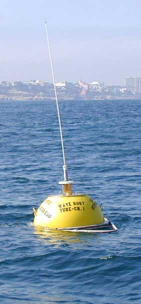
Station 46244
Wave Height
--ft
Wave Dir
--
Wind Speed
--kt
Wind Dir
--
Water Temp
58°F
Air Temp
--°F
Pressure
--mb
Observation: Sep 13, 2026 12:00 PM UTC | View on NDBC
Buoy History (48 Hours)
Wave height (blue) and dominant wave period (orange) from the NDBC buoy over the last 48 hours. Longer wave periods typically indicate ocean swell; shorter periods suggest local wind waves.
Buoy wave data chart showing wave height and period. Data table follows.
| Date/Time | Wave Height (ft) | Wave Period (sec) |
|---|
🐻 California Fishing Resources
California Dept. of Fish & Wildlife (CDFW)Get Alerts
Get notified when Humboldt Bay conditions change.
Free account — email & text alerts